In July, we took a trip to the Lake District and were fortunate to capture a few not so photographed locations. We wanted to share 2 of our most favourite.
Nestled in the heart of Borrowdale, Castle Crag might not be the highest point in the Lake District, but it offers one of the most dramatic views. From above, the crag stands tall, surrounded by lush greenery and meandering river valleys. The drone footage revealed details of the terrain that are often missed from the ground – the rocky outcrops, dense forests, and the winding path leading to the summit. The play of light and shadow as the sun set over Borrowdale created some truly magical shots.
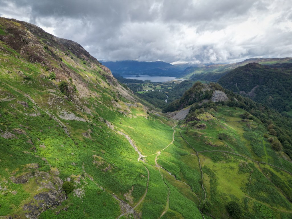
Aerial photography allows us to see these iconic spots from a whole new perspective. While many people climb these fells for the sense of accomplishment and panoramic views, capturing them from the sky brings out a level of detail and grandeur that is otherwise hard to appreciate.
Drone Considerations in the Lake District
The Lake District is known for its unpredictable weather, and the fells can experience strong mechanical winds, especially at higher altitudes. Before flying, make sure to check the wind speed at different elevations. Gusty conditions can make drone control difficult and drain your battery faster.
The Lake District has many towering fells, and it’s essential to remember the 400ft above ground level legal limit for drones in the UK. Ensure you’re aware of your altitude to avoid flying too high, especially within high peaks and low valleys.
The Lake District is within a Low Flying Area for military aircraft. Fast jets can appear suddenly and fly low, particularly in areas with long stretching valleys. Always be vigilant and listen for jets. If you hear one approaching, descend your drone immediately to avoid any potential conflict.
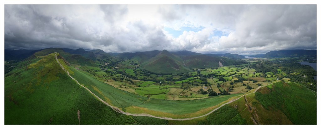
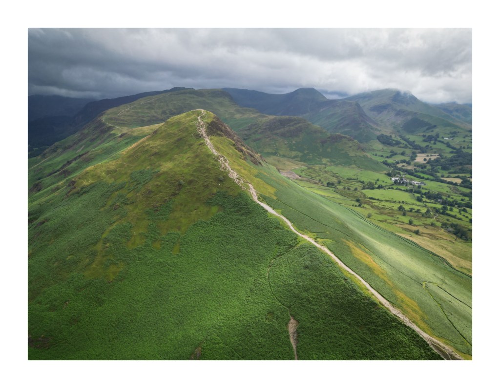
No trip to the Lake District is complete without visiting Catbells, one of the most popular fells in the region. Flying our drone along the ridge, we captured sweeping views of Derwentwater below, with the distant peaks of the surrounding fells framing the horizon. The beauty of the landscape is awe-inspiring from this vantage point, and we captured a combination of wide-angle shots and close-ups of the rugged terrain.
How to Access These Spots
If you’re thinking of visiting these spectacular locations, here are a few tips to help you plan:
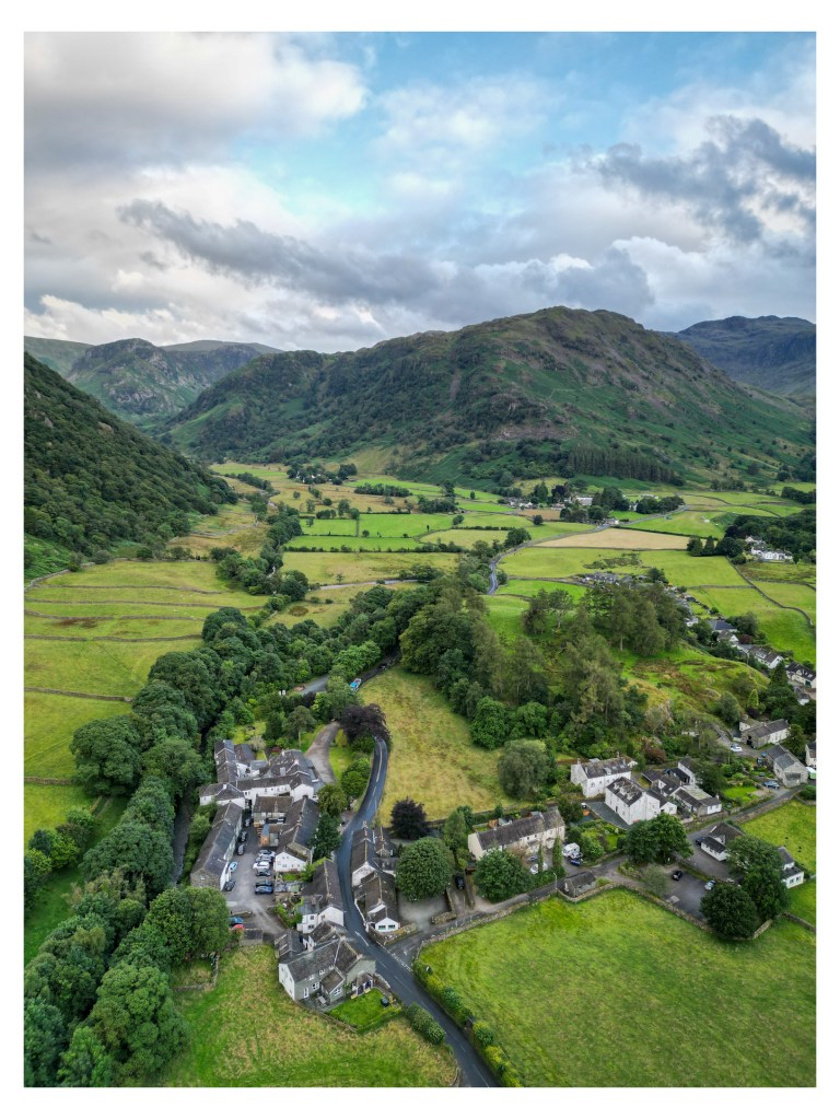
- Castle Crag: Accessing Castle Crag is a rewarding yet manageable hike. The starting point is Rosthwaite, a small village in Borrowdale. From there, a short 2-mile hike will take you to the summit, with the path winding through ancient woodlands and offering views of the River Derwent along the way. Parking is available at Rosthwaite or nearby Grange.
- Catbells: This fell is one of the most accessible in the Lake District, making it perfect for both beginners and seasoned hikers. You can start from the Hawes End car park for a direct ascent or take a longer, circular route from Keswick. The hike is just under 4 miles, offering incredible views throughout.
T-Hathaway Aerial Photograpy
Drone Photography & Aerial Surveys | UK
