
In agriculture, the ability to make informed, data-driven decisions can significantly affect crop yield, profitability, and sustainable land use.
One of the most powerful tools transforming modern farming is drone technology, which allows farmers to create accurate field maps and estimate yield with high precision.

By providing real-time, actionable insights, drone surveys are revolutionising the way farmers manage their fields.
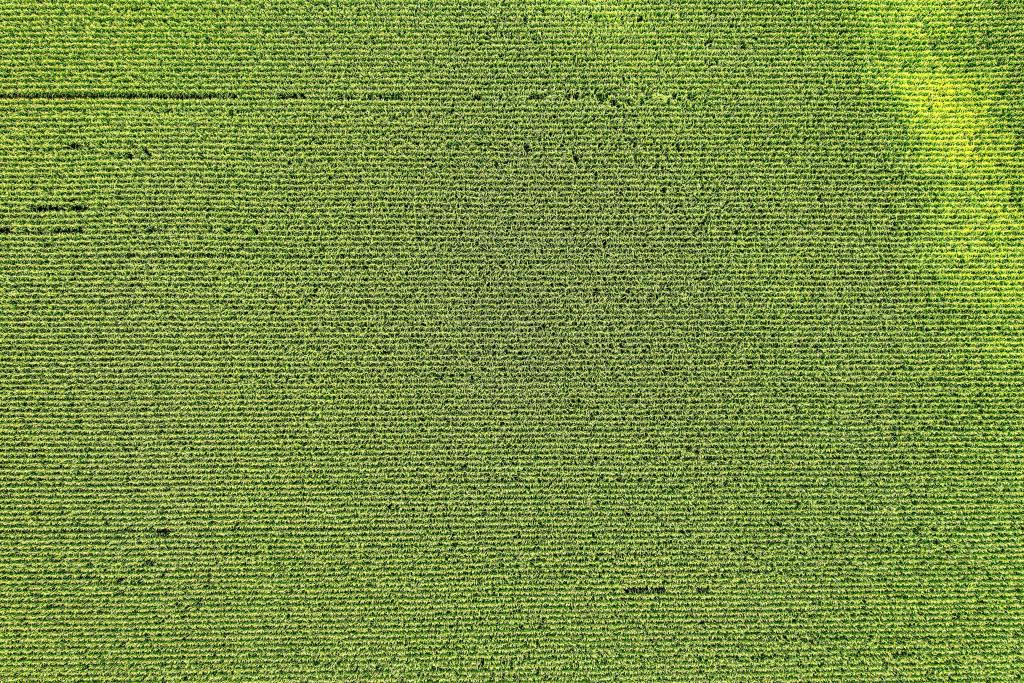
Common issues which can be identified with aerial imagery:
Crop Health Variations:
- Areas with inconsistent coloration (often indicating poor health).
- Indices like NDVI or SAVI are able to highlight vegetation health.
Soil Compaction:
- Compacted areas will often look bare or have stunted crop growth, as plants struggle to establish strong roots.
Erosion:
- Erosion can strip away topsoil, which is rich in nutrients necessary for crop growth.
- Patterns like streaks or “washed” appearances.
Weed Infestation:
- Areas with abnormal plant growth or color variation could suggest weed growth.
Pest Damage:
- Irregular patterns or small patches where crops look thinned out or discolored.
Nutrient Deficiencies:
- Discoloration can signal nutrient issues; yellowish areas often indicate nitrogen deficiency.
Poor Drainage or Waterlogging:
- Areas with poor drainage often experience waterlogging, which can drown crops and result in barren spots.
Plant Density:
- Uneven planting density can suggest seeding issues or poor germination rates.
Here’s how drone-based mapping can support better planning and decision-making:
Introduction
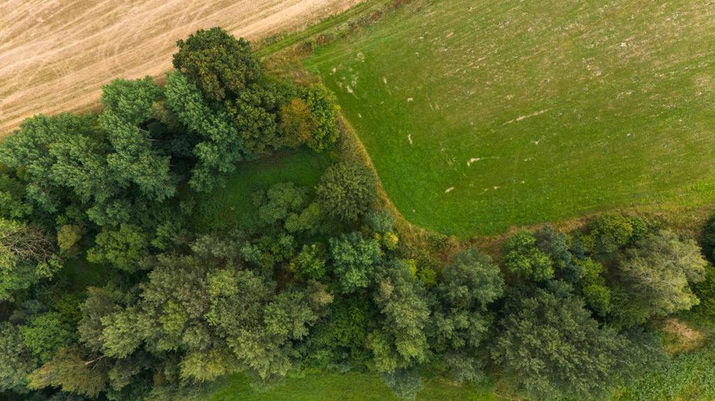
Drones create high-resolution 2D and 3D maps that reveal essential details about the land’s topography, such as slopes, elevation changes, and other geographical features.
This level of detail provides farmers with a comprehensive understanding of their land’s layout, helping them plan and make adjustments for optimal field performance.
- Topographical Insights: 3D maps generated by drones show every subtle change in elevation across a field. These maps enable farmers to identify slopes, flat areas, and potential low-lying spots that may accumulate water or be prone to erosion.
- Optimising drainage: By understanding the land’s natural contours, farmers can design drainage systems that direct water flow efficiently. This prevents pooling in certain areas and ensures that water reaches all parts of the field evenly, protecting crops from both under- and over-watering.
- Future Planting and Land Use: A detailed map helps farmers plan crop placement based on the field’s unique layout. Areas with better drainage, soil quality, or sunlight exposure can be earmarked for high-value crops, while less ideal areas may be reserved for cover crops.
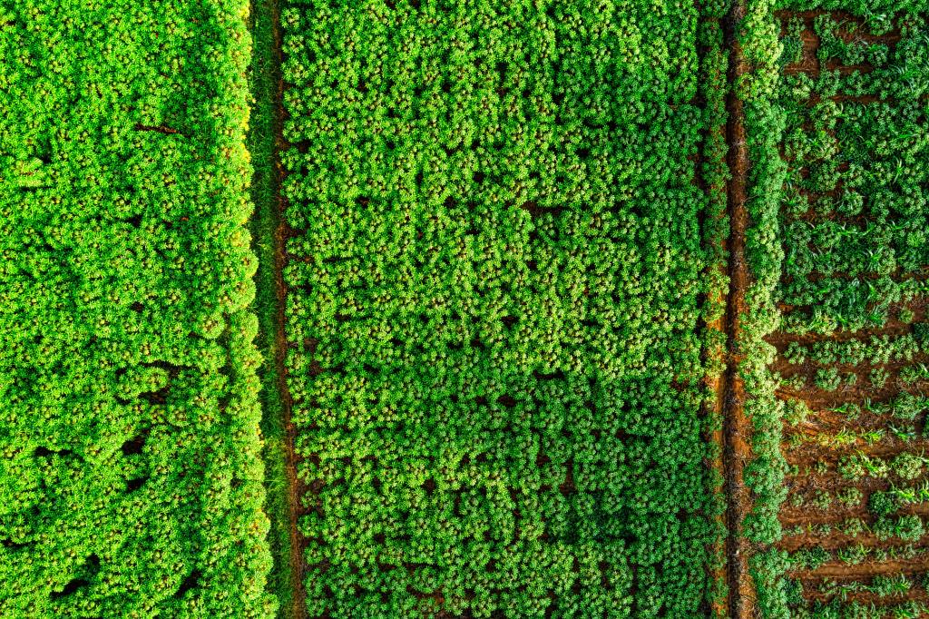
Plant Counting and Yield Estimation
For large agribusinesses, estimating crop yields, allows farmers to prepare for market demands and set realistic expectations. Drone technology simplifies this process by accurately analysing plant density, size, and other indicators of crop health and maturity.
- Precision Plant Counting: Advanced imaging and AI algorithms analyse drone footage to count plants within a field. For large fields, this is a massive time-saver compared to manual counting and offers greater accuracy, especially for high-density crops.
- Yield Prediction Models: Drones collect data on plant size, density, and growth stages, which can be used to predict yield. By monitoring these variables, farmers gain a reliable estimate of how much crop they can expect to harvest. This information is invaluable for scheduling labour, allocating storage resources, and aligning with market demands.
- Adjusting for Market Demand: Armed with accurate yield predictions, farmers can adjust their planting and harvesting strategies to meet market demand. If a particular crop is expected to have higher yield than needed, farmers can consider alternative uses or focus on quality management to optimise returns.
Seasonal Planning
A single drone flight provides powerful insights, but multiple flights over time create a valuable dataset that reveals trends in soil quality, water usage, and crop health.
This accumulated data enables farmers to make informed seasonal plans that maximise productivity year after year.
- Identifying Patterns and Trends: Drone surveys capture how crop health, soil moisture, and nutrient levels change over the growing season. By analysing this data, farmers can identify recurring patterns or problem areas, such as parts of the field that are consistently waterlogged or soil that may require extra fertilisation.
- Optimising Crop Rotation and Soil Management: By mapping historical data on crop yields and soil health, farmers can create crop rotation schedules that maintain soil fertility and reduce disease risks. For example, if a field shows nutrient depletion after a particular crop, farmers can plan to plant a nitrogen-fixing crop the following season.
- Water and Resource Management: Seasonal data helps farmers fine-tune irrigation practices, ensuring that water is applied precisely where and when it’s needed. Over time, this can reduce water usage, conserve resources, and contribute to more sustainable farming practices.
Conclusion
Accurate field mapping and yield estimation with drones provide farmers with a clearer, more detailed view of their land and crops. The insights derived from drone surveys allow for smarter, more strategic planning, reducing risks and maximising productivity. By enabling farmers to optimise field layouts, predict yields, and plan seasonally, drones are proving to be an indispensable tool in the journey towards more efficient, data-driven, and sustainable agriculture.
T-Hathaway Aerial Photograpy
Drone Photography & Aerial Surveys | UK
Contact us for more information
