Technical Inspection Services for Insurers, Businesses & Property Owners
Traditional roof inspections are often constrained by access limitations, safety risks, and incomplete visual coverage. Our drone-based inspection services provide a non-intrusive, data-driven alternative, delivering high-resolution aerial evidence suitable for insurance assessments, asset management, and property condition reporting across Yorkshire and the North of England.
We support insurers, loss adjusters, commercial asset managers, and private property owners with objective visual data that improves decision-making, reduces site risk, and accelerates inspection timelines.
Technical Inspection Capabilities
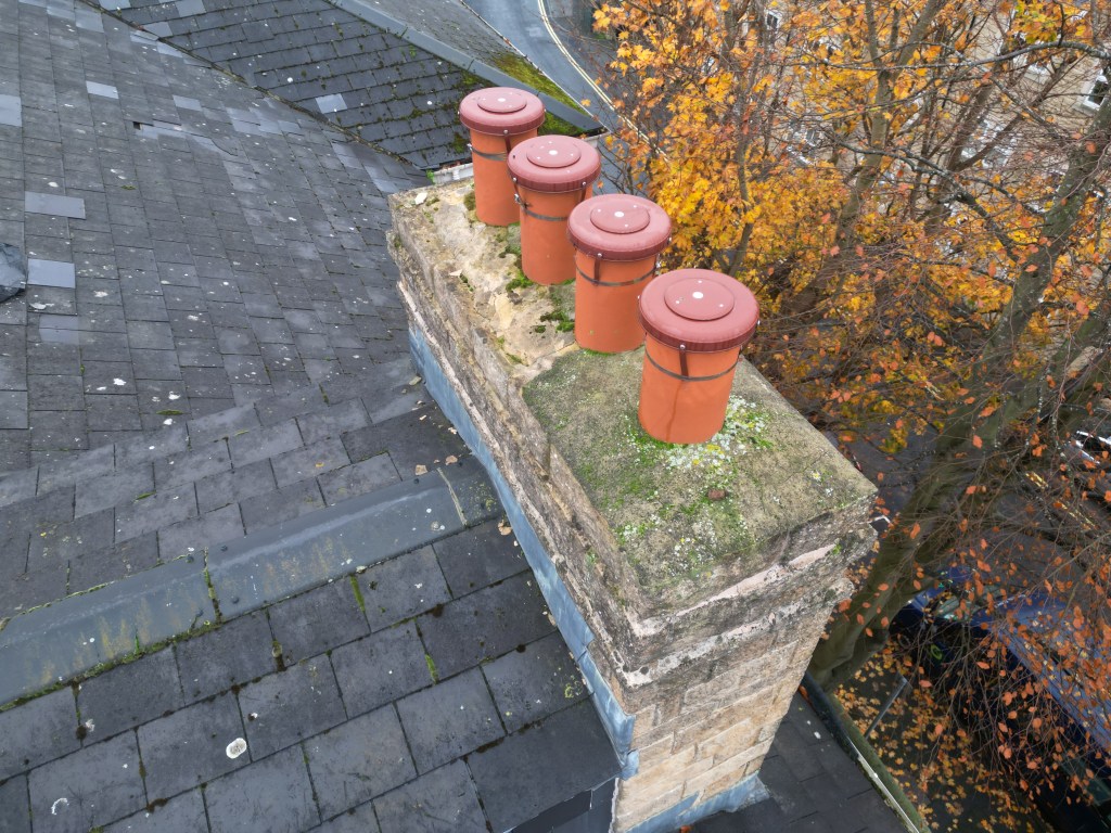
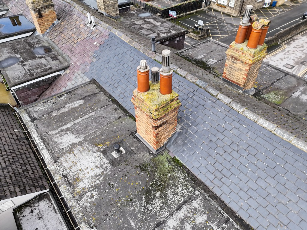
Roof & Building Envelope Condition Surveys
High-resolution aerial surveys provide full coverage of inaccessible or hazardous areas without the need for scaffolding or MEWPs. Suitable for residential, commercial, and industrial properties.
Common assessment outputs include identification of:
- Broken, displaced, or missing tiles and slates
- Degraded leadwork, flashing, and parapet details
- Blocked or damaged guttering and drainage paths
- Impact, storm, or fire-related damage
- General roof condition for lifecycle and maintenance planning
All imagery is captured with consistent overlap and perspective, allowing for accurate post-inspection review and comparison.
Insurance Claims & Loss Adjustment Support
We provide timestamped, georeferenced imagery and video designed to support claim validation and technical review. Data can be used to:
- Differentiate sudden insured events from long-term wear and tear
- Establish pre and post incident condition
- Support remote desktop assessments and third-party review
- Reduce site visits and inspection delays
Deliverables are suitable for inclusion within insurer claim files and loss adjustment reports.
Orthomosaic Mapping & 3D Asset Modelling
Using photogrammetric processing, multiple overlapping images are stitched into a single, scale-accurate orthomosaic and optional 3D model.
- Applications: Roof area measurement, defect referencing, reconstruction planning, and capital expenditure estimation
- Outputs: Geo-referenced orthomosaics, 3D mesh models, and measurement-ready datasets
This approach provides a permanent digital record of asset condition at the time of inspection.
Equipment, Compliance & Risk Management
All operations are conducted in accordance with UK aviation legislation and industry best practice.
- Imaging Sensors:
- 4K HDR video
- Up to 50MP high-resolution still imagery
- Thermal Sensors: Radiometric
- Insurance: £5m–£10m Public Liability (EC 785/2004 compliant)
- Risk Controls: Site-specific risk assessments, controlled flight plans, and structured data capture methodologies
Operational Benefits for Insurers & Property Owners
- Risk Reduction: Eliminates working-at-height exposure
- Time Efficiency: Rapid mobilisation and data capture
- Cost Control: No access equipment, plant hire, or traffic management
- Data Quality: High-resolution, repeatable datasets suitable for longitudinal comparison
- Minimal Disruption: Inspections carried out without interrupting site operations or occupancy
Service Coverage
We operate across Yorkshire, the North East, and the North West, supporting urban, industrial, rural, and heritage assets.
Typical clients include:
- Insurance providers and loss adjusters
- Facilities and asset managers
- Commercial landlords and developers
- Homeowners requiring independent roof assessments
If you require objective aerial evidence, rapid post-incident assessment, or a safer alternative to traditional access methods, we’re ready to support your inspection needs.
Request a quote or schedule an inspection by contacting us below:
T-Hathaway Aerial Photograpy
Drone Photography & Aerial Surveys | UK
